
Drone Property Photographer London

Drone photography from £275. Properties within flight restrictions zones £350.
£225 or £300 w/any regular photography package.
I am text block. Click edit button to change this text. Lorem ipsum dolor sit amet, consectetur adipiscing elit. Ut elit tellus, luctus nec ullamcorper mattis, pulvinar dapibus leo.
Trusted Drone Photography Services
London Estate Photography is the leading drone photography service for affordable and bespoke drone property photography in London. Our aerial photography provides bespoke drone images for estate agents, property owners, investors, commercial developers, construction sites, Airbnb hosts, and more.
Experienced In Aerial Imagery
Professional drone pilot Frank Biganski is a certified remote drone pilot since 2018. Frank holds a GVC certification from the CAA in the United Kingdom. In addition, Frank also holds an A1 certification in Switzerland/Europe and a Part 107 certification from the FAA in the United States. Frank’s years of experience and training will deliver affordable stunning drone photography. In turn, this will provide a unique perspective to elevate your property marketing.
With over 140 hours of logged drone flight time and over 615 drone flights, clients can rest assured that Frank’s commitment to safety and quality goes unsurpassed. Furthermore, every flight is backed by Frank’s professional certifications and comprehensive insurance policies to ensure your project is conducted in a professional manor to deliver exceptional imagery every time.


London Drone Property Photography
London Estate Photography provides drone property photography services across all London boroughs. Furthermore, photographer Frank Biganski holds a certified remote pilot status granted by the Civil Aviation Authority (CAA) with a GVC Operational Authorization. Consequently, this accreditation enables Frank to conduct drone property photography flights across the United Kingdom and Scotland. Notably, possessing the GVC certification demonstrates Frank’s completion of thorough training and testing, ensuring the highest standards of safety in all London drone property photography operations he undertakes.
- £1 Million (£750,000,000 SPR’s) EC 785/2004
- £5 Million Public Liability
- £150,000 Indemnity
London Commercial Drone Photography
London Estate Photography is proud to have been contracted by Richardson Projects to photograph many of their completed projects throughout London. Richardson Projects was contracted to install the facades, siding and roofing at several dozen locations to include Bond Street Station, Orme Court, and the Park Modern to name a few. 😎


Drone Photography for £225
Customers can add drone property photography to any regular property photo package for an additional £225; £300 including VAT for properties in flight restriction zones. This will provide about 10-20 drone images to highlight the subject property. For example, images might provide the property’s location to the City of London or just a bird’s eye view of a property. Moreover, it may accentuate a lovely garden, pool, show extensive landscaping, or provide an eye-level view of a penthouse flat, or proximity to train station or areas of interest.
All imagery is photographed in high resolution RAW and edited and delivered as 3000 x 2000 pixels at 150 dpi. Customers may request higher solution images which can be delivered at 8064×4536 pixels at 300 dpi in either JPG or TIFF files. There’s no additional charge for providing higher resolution images.
Drone Photography for £275
Drone photography ordered alone is priced from £275 and properties located within a flight restriction zone is £350 including VAT. This will provide about 15-30 drone images to highlight the subject property.
All pricing described herein is based upon properties located within the circular area inside of Croydon, Richmond, Hackney, and Abbey Wood. Price increases if property is located in rural areas of London by approximately £100-£200. For example, we charge £375 to £425 for a property in Woking, and £425 to £475 for a property past Shenfield in Wickford or Chelmsford.
If your property is located is a rural area, please contact Frank and he’ll provide a fast and free no-obligation quote for you.
Drone Photography for £350
We charge a total of £350 (including VAT) for properties within flight restriction zones 157 or 158, which covers areas around Regent’s Park, Hyde Park, Westminster, Blackfriars, and St. Paul’s Cathedral. This total combines a £275 base fee and a £75 surcharge. For locations in Shenfield, Wickford, or Chelmsford, the price ranges from £425 to £475. The additional fee is for the time to draft a flight plan and submit that plan to NATS for legal flight approval. Properties located within the London Heliport near Battersea and Fulham will incur an additional £75 which covers the cost and time to obtain flight authorization from the London Heliport. Flight approval within the London Heliport flight zone are completely dependant upon their approval.
You must submit all flight requests at least seven (7) days in advance, and Frank typically receives an approval or rejection within 2–3 days.
To ensure Frank can fly on the sunniest day possible, management typically grants him a 30-day flight window. However, he must conduct all flights on non-rainy days when sustained winds remain below 30 mph. This 30-day window is also necessary because drone flights cannot occur within 50 meters of an operating tower crane. Consequently, Sundays are typically the only days Frank can fly.
The Royal Parks
Flying a drone within and over any of the Royal Parks is nearly never approved. And if it is approved, a very explicit and comprehensive Risk Assessment Mitigation must be completed and approved by the Royal Parks and accompanied by a £240 fee payable to The Royal Parks. Due to the time and complexity of these types of drone flights, we typically will refer you to another drone agency that works at this level. The cost can become quite expensive, exceeding £1,000 and many weeks of waiting for approvals. If you do have a need for drone photography or video within any of the Royal Parks, please contact Frank and he will be happy to provide you with or quote, or refer you to another drone company.
London Heathrow Airport
For properties located within the London Heathrow Airport flight restriction zones, every flight must be assessed on a case-by-case basis. Some area are limited to altitudes much lower than 120 meters/400 feet so please contact Frank for a quote.
HM Prisons
Unfortunately, Frank choses not to accept drone flights for properties that are located within a HMP no fly zone. To preview if you property is located within a prison no fly zone, please review this map: https://tinyurl.com/London-Flight-Restriction-Map
Increase online click-thru rates by nearly 70%
Drone images consistently drive more calls and click-throughs than listings without them. Most London council bylaws allow you to use drones to photograph any property, provided you follow a few key rules. First, you must meet all Civil Aviation Authority (CAA) stipulations and Air Navigation Order 2016 guidelines. Second, these rules allow you to launch low-risk drones weighing under 249 grams from private property. Third, only a few London councils require a certified remote pilot to operate the flight. Lastly, almost all councils ban drone launches in public parks and open spaces.
Moreover, “filming” or videotaping in and over most boroughs requires council permission and approval. In turn, this involves making application with the Council, paying a nominal fee, and waiting about 10 working days for approval. Conversely, the customer and remote pilot could face fines if they do not adhere to byelaws. In short, it’s always best to hire a certified remote drone pilot before engaging in any commercial drone operations.

London Drone Property Photography
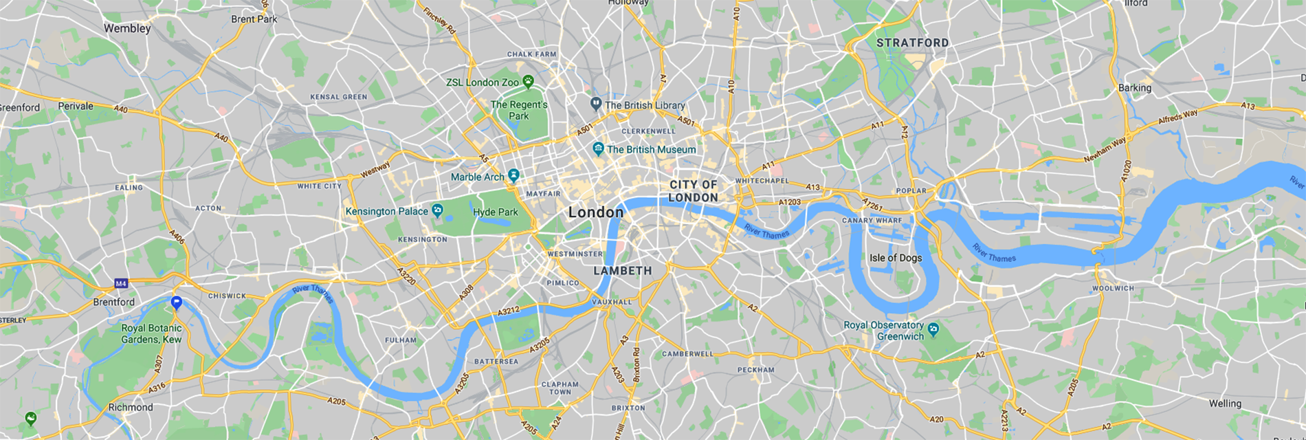
Launching a drone within restricted airspace, as illustrated in the map below, is allowable under specific conditions. However, prior to commencing such operations, a certified remote pilot must secure approval from the National Air Traffic Services (NATS). We must apply for flight authorization at least seven days before your flight. To ensure you get the best images despite England’s wet weather, we’re typically granted a two-week “weather window” for all drone operations. Finally, on the day of flight, the drone pilot must receive a flight code from the Parliamentary and Diplomatic Protection agency 60 minutes prior to flight.

Low-Risk Lightweight Drones
Frank actively provides drone property photography services across every London borough. A GVC Operational Authorization from the CAA enables this service. Moreover, Frank’s status as a certified remote pilot empowers him to conduct drone property photography flights throughout the United Kingdom and Scotland. Notably, the possession of the GVC certification attests to Frank’s completion of rigorous training and testing. Consequently, this guarantees the utmost safety standards in all his operations involving London drone property photography.
For this purpose, Frank has curated a list of London boroughs allowing the launch of drones for photographic purposes on private land. He sourced this information directly from the Council websites which primarily focuses on drone usage over parks and public spaces. However, the list specifically applies to private property launches and photography, excluding filming and videotaping activities.
In instances where councils lack defined drone rules or bylaws, the regulations set by the Civil Aviation Authority (CAA) take precedence. CAA drone laws are consistently enforceable. London Estate Photography does not assume responsibility or liability for the provided information. This information does not constitute legal advice. Adherence to CAA UAS drone laws, outlined in The Air Navigation Order 2016, remains mandatory.